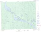
Maps showing Étangs Kapitukamakwau, Baie-James; Jamésie, Quebec
Étangs Kapitukamakwau is a Lake located in Baie-James; Jamésie, Quebec.
- Latitude: 51° 9' 35'' North (decimal: 51.1597222)
- Longitude: 78° 52' 11'' West (decimal: -78.8697222)
- Topography Feature Category: Lake
- Geographical Feature: Étangs
- Canadian Province/Territory: Quebec
- Location: Baie-James; Jamésie
- Atlas of Canada Locator Map: Étangs Kapitukamakwau
- GPS Coordinate Locator Map: Étangs Kapitukamakwau Lat/Long
Étangs Kapitukamakwau NTS Map Sheets