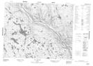
Maps showing Ruisseau Uhakameku, Petit-Mécatina; Minganie, Quebec
Ruisseau Uhakameku is a River located in Petit-Mécatina; Minganie, Quebec.
- Latitude: 51° 53' 42'' North (decimal: 51.8950736)
- Longitude: 59° 10' 36'' West (decimal: -59.1766091)
- Topography Feature Category: River
- Geographical Feature: Ruisseau
- Canadian Province/Territory: Quebec
- Location: Petit-Mécatina; Minganie
- Atlas of Canada Locator Map: Ruisseau Uhakameku
- GPS Coordinate Locator Map: Ruisseau Uhakameku Lat/Long
Ruisseau Uhakameku NTS Map Sheets