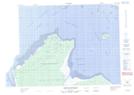
Maps showing Rocher Hallé, Baie-James; Jamésie, Quebec
Rocher Hallé is a Island located in Baie-James; Jamésie, Quebec.
- Latitude: 51° 42' 10'' North (decimal: 51.7027778)
- Longitude: 79° 0' 52'' West (decimal: -79.0144444)
- Topography Feature Category: Island
- Geographical Feature: Rocher
- Canadian Province/Territory: Quebec
- Location: Baie-James; Jamésie
- Atlas of Canada Locator Map: Rocher Hallé
- GPS Coordinate Locator Map: Rocher Hallé Lat/Long
Rocher Hallé NTS Map Sheets