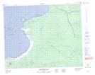
Maps showing Rocher Kamihkwapishau, Baie-James; Jamésie, Quebec
Rocher Kamihkwapishau is a Island located in Baie-James; Jamésie, Quebec.
- Latitude: 51° 54' 26'' North (decimal: 51.9072222)
- Longitude: 78° 53' 39'' West (decimal: -78.8941667)
- Topography Feature Category: Island
- Geographical Feature: Rocher
- Canadian Province/Territory: Quebec
- Location: Baie-James; Jamésie
- Atlas of Canada Locator Map: Rocher Kamihkwapishau
- GPS Coordinate Locator Map: Rocher Kamihkwapishau Lat/Long
Rocher Kamihkwapishau NTS Map Sheets