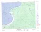
Maps showing Rocher Akamuwashau, Baie-James; Jamésie, Quebec
Rocher Akamuwashau is a Island located in Baie-James; Jamésie, Quebec.
- Latitude: 51° 54' 50'' North (decimal: 51.9138889)
- Longitude: 78° 53' 00'' West (decimal: -78.8833333)
- Topography Feature Category: Island
- Geographical Feature: Rocher
- Canadian Province/Territory: Quebec
- Location: Baie-James; Jamésie
- Atlas of Canada Locator Map: Rocher Akamuwashau
- GPS Coordinate Locator Map: Rocher Akamuwashau Lat/Long
Rocher Akamuwashau NTS Map Sheets