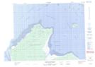
Maps showing Rocher Kautehapiskuch, Baie-James; Jamésie, Quebec
Rocher Kautehapiskuch is a Island located in Baie-James; Jamésie, Quebec.
- Latitude: 51° 37' 17'' North (decimal: 51.6213889)
- Longitude: 79° 23' 10'' West (decimal: -79.3861111)
- Topography Feature Category: Island
- Geographical Feature: Rocher
- Canadian Province/Territory: Quebec
- Location: Baie-James; Jamésie
- Atlas of Canada Locator Map: Rocher Kautehapiskuch
- GPS Coordinate Locator Map: Rocher Kautehapiskuch Lat/Long
Rocher Kautehapiskuch NTS Map Sheets