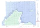
Maps showing Ruisseau Kutipeu Katahkukwau, Baie-James; Jamésie, Quebec
Ruisseau Kutipeu Katahkukwau is a River located in Baie-James; Jamésie, Quebec.
- Latitude: 51° 30' 34'' North (decimal: 51.5094444)
- Longitude: 79° 3' 25'' West (decimal: -79.0569444)
- Topography Feature Category: River
- Geographical Feature: Ruisseau
- Canadian Province/Territory: Quebec
- Location: Baie-James; Jamésie
- Atlas of Canada Locator Map: Ruisseau Kutipeu Katahkukwau
- GPS Coordinate Locator Map: Ruisseau Kutipeu Katahkukwau Lat/Long
Ruisseau Kutipeu Katahkukwau NTS Map Sheets