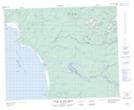
Maps showing Marais Kashakuschekach, Baie-James; Jamésie, Quebec
Marais Kashakuschekach is a Low vegetation located in Baie-James; Jamésie, Quebec.
- Latitude: 51° 31' 53'' North (decimal: 51.5313889)
- Longitude: 78° 35' 31'' West (decimal: -78.5919444)
- Topography Feature Category: Low vegetation
- Geographical Feature: Marais
- Canadian Province/Territory: Quebec
- Location: Baie-James; Jamésie
- Atlas of Canada Locator Map: Marais Kashakuschekach
- GPS Coordinate Locator Map: Marais Kashakuschekach Lat/Long
Marais Kashakuschekach NTS Map Sheets