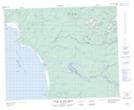
Maps showing Colline Upemuew, Baie-James; Jamésie, Quebec
Colline Upemuew is a Mountain located in Baie-James; Jamésie, Quebec.
- Latitude: 51° 39' 37'' North (decimal: 51.6602778)
- Longitude: 78° 54' 9'' West (decimal: -78.9025)
- Topography Feature Category: Mountain
- Geographical Feature: Colline
- Canadian Province/Territory: Quebec
- Location: Baie-James; Jamésie
- Atlas of Canada Locator Map: Colline Upemuew
- GPS Coordinate Locator Map: Colline Upemuew Lat/Long
Colline Upemuew NTS Map Sheets