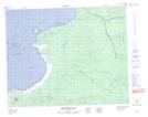
Maps showing Confluent Emachistewemichuskashich, Baie-James; Jamésie, Quebec
Confluent Emachistewemichuskashich is a River feature located in Baie-James; Jamésie, Quebec.
- Latitude: 51° 59' 42'' North (decimal: 51.995)
- Longitude: 78° 40' 6'' West (decimal: -78.6683333)
- Topography Feature Category: River feature
- Geographical Feature: Confluent
- Canadian Province/Territory: Quebec
- Location: Baie-James; Jamésie
- Atlas of Canada Locator Map: Confluent Emachistewemichuskashich
- GPS Coordinate Locator Map: Confluent Emachistewemichuskashich Lat/Long
Confluent Emachistewemichuskashich NTS Map Sheets