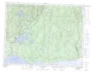
Maps showing Rivière-Pigou, Sept-Îles; Sept-Rivières, Quebec
Rivière-Pigou is a Unincorporated area located in Sept-Îles; Sept-Rivières, Quebec and has an elevation of 21 meters.
- Latitude: 50° 16' 25'' North (decimal: 50.2736111)
- Longitude: 65° 34' 21'' West (decimal: -65.5725)
- Topography Feature Category: Unincorporated area
- Geographical Feature: Hameau
- Canadian Province/Territory: Quebec
- Elevation: 21 meters
- Location: Sept-Îles; Sept-Rivières
- Atlas of Canada Locator Map: Rivière-Pigou
- GPS Coordinate Locator Map: Rivière-Pigou Lat/Long
Rivière-Pigou NTS Map Sheets