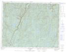
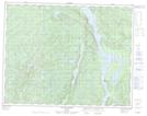
Maps showing Lac Atauakamis, Lac-Jérôme; Minganie, Quebec
Lac Atauakamis is a Lake located in Lac-Jérôme; Minganie, Quebec.
- Latitude: 50° 45' 15'' North (decimal: 50.7541667)
- Longitude: 64° 33' 31'' West (decimal: -64.5586111)
- Topography Feature Category: Lake
- Geographical Feature: Lac
- Canadian Province/Territory: Quebec
- Location: Lac-Jérôme; Minganie
- Atlas of Canada Locator Map: Lac Atauakamis
- GPS Coordinate Locator Map: Lac Atauakamis Lat/Long
Lac Atauakamis NTS Map Sheets