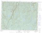
Maps showing Portage Kapiputiauatshinant, Lac-Jérôme; Minganie, Quebec
Portage Kapiputiauatshinant is a Road feature located in Lac-Jérôme; Minganie, Quebec.
- Latitude: 50° 38' 32'' North (decimal: 50.6422222)
- Longitude: 64° 34' 41'' West (decimal: -64.5780556)
- Topography Feature Category: Road feature
- Geographical Feature: Portage
- Canadian Province/Territory: Quebec
- Location: Lac-Jérôme; Minganie
- Atlas of Canada Locator Map: Portage Kapiputiauatshinant
- GPS Coordinate Locator Map: Portage Kapiputiauatshinant Lat/Long
Portage Kapiputiauatshinant NTS Map Sheets