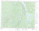
Maps showing Baie Atauakamu, Lac-Jérôme; Minganie, Quebec
Baie Atauakamu is a Bay located in Lac-Jérôme; Minganie, Quebec.
- Latitude: 50° 51' 57'' North (decimal: 50.8658333)
- Longitude: 64° 33' 9'' West (decimal: -64.5525)
- Topography Feature Category: Bay
- Geographical Feature: Baie
- Canadian Province/Territory: Quebec
- Location: Lac-Jérôme; Minganie
- Atlas of Canada Locator Map: Baie Atauakamu
- GPS Coordinate Locator Map: Baie Atauakamu Lat/Long
Baie Atauakamu NTS Map Sheets