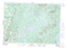
Maps showing La Pointe, Saint-Malo; Coaticook, Quebec
La Pointe is a Unincorporated area located in Saint-Malo; Coaticook, Quebec and has an elevation of 493 meters.
- Latitude: 45° 12' 9'' North (decimal: 45.2025442)
- Longitude: 71° 26' 55'' West (decimal: -71.4486929)
- Topography Feature Category: Unincorporated area
- Geographical Feature: Lieu-dit
- Canadian Province/Territory: Quebec
- Elevation: 493 meters
- Location: Saint-Malo; Coaticook
- Atlas of Canada Locator Map: La Pointe
- GPS Coordinate Locator Map: La Pointe Lat/Long