Canada Topographic Maps

Lac-Huron Topo Maps

Topography maps and Latitude/Longitude Location

Maps showing Lac-Huron, Lac-Huron; Rimouski-Neigette, Quebec

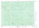
Lac-Huron is a Other municipal/district area - miscellaneous located in Lac-Huron; Rimouski-Neigette, Quebec.

  • Latitude: 48° 12' North   (decimal: 48.2000000)
  • Longitude: 68° 14' West   (decimal: -68.2333333)
  • Topography Feature Category: Other municipal/district area - miscellaneous
  • Geographical Feature: Territoire non organisé
  • Canadian Province/Territory: Quebec
  • Location: Lac-Huron; Rimouski-Neigette
  • Atlas of Canada Locator Map: Lac-Huron
  • GPS Coordinate Locator Map: Lac-Huron Lat/Long

Lac-Huron NTS Map Sheets

021N16 Wild Goose Lake Topographic Map at 1:50,000 scale

022B04 Lac Des Chasseurs Topographic Map at 1:50,000 scale

022C01 Lac Prime Topographic Map at 1:50,000 scale

022C08 Sainte-Blandine Topographic Map at 1:50,000 scale

021N Edmundston Topographic Map at 1:250,000 scale

022B Matane Topographic Map at 1:250,000 scale

022C Rimouski Topographic Map at 1:250,000 scale

 
Buy Topographic Maps DVD
Newsletter Sign-up

Yes, I want to receive map store discounts.


Bookmark and Share