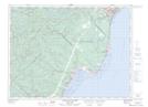
Maps showing Petite pointe à Boisvert, Longue-Rive; La Haute-Côte-Nord, Quebec
Petite pointe à Boisvert is a Cape located in Longue-Rive; La Haute-Côte-Nord, Quebec.
- Latitude: 48° 34' 33'' North (decimal: 48.5758598)
- Longitude: 69° 11' 53'' West (decimal: -69.1981070)
- Topography Feature Category: Cape
- Geographical Feature: Pointe
- Canadian Province/Territory: Quebec
- Location: Longue-Rive; La Haute-Côte-Nord
- Atlas of Canada Locator Map: Petite pointe à Boisvert
- GPS Coordinate Locator Map: Petite pointe à Boisvert Lat/Long
Petite pointe à Boisvert NTS Map Sheets