Maps showing Écluse du Six-Milles, Forestville; La Haute-Côte-Nord, Quebec
Écluse du Six-Milles is a Hydraulic construction located in Forestville; La Haute-Côte-Nord, Quebec.
- Latitude: 48° 43' 26'' North (decimal: 48.7239183)
- Longitude: 69° 9' 28'' West (decimal: -69.1578285)
- Topography Feature Category: Hydraulic construction
- Geographical Feature: Barrage
- Canadian Province/Territory: Quebec
- Location: Forestville; La Haute-Côte-Nord
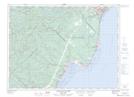
- Atlas of Canada Locator Map: Écluse du Six-Milles
- GPS Coordinate Locator Map: Écluse du Six-Milles Lat/Long
Écluse du Six-Milles NTS Map Sheets