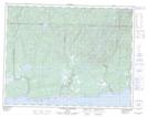
Maps showing Sheldrake, Rivière-au-Tonnerre; Minganie, Quebec
Sheldrake is a Unincorporated area located in Rivière-au-Tonnerre; Minganie, Quebec.
- Latitude: 50° 15' 53'' North (decimal: 50.2647222)
- Longitude: 64° 53' 57'' West (decimal: -64.8991666)
- Topography Feature Category: Unincorporated area
- Geographical Feature: Bureau de poste
- Canadian Province/Territory: Quebec
- Location: Rivière-au-Tonnerre; Minganie
- Atlas of Canada Locator Map: Sheldrake
- GPS Coordinate Locator Map: Sheldrake Lat/Long
Sheldrake NTS Map Sheets