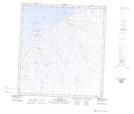
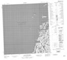
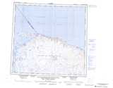
Maps showing Havre Nuvuk, Baie-d'Hudson; Kativik, Quebec
Havre Nuvuk is a Bay located in Baie-d'Hudson; Kativik, Quebec and has an elevation of 0 meters.
- Latitude: 62° 24' 23'' North (decimal: 62.4064479)
- Longitude: 77° 58' 31'' West (decimal: -77.9751665)
- Topography Feature Category: Bay
- Geographical Feature: Havre
- Canadian Province/Territory: Quebec
- Elevation: 0 meters
- Location: Baie-d'Hudson; Kativik
- Atlas of Canada Locator Map: Havre Nuvuk
- GPS Coordinate Locator Map: Havre Nuvuk Lat/Long
Havre Nuvuk NTS Map Sheets
035L Map Not Available Topographic Map at 1:250,000 scale
