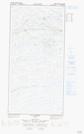
Maps showing Illuviniit, Baie-d'Hudson; Kativik, Quebec
Illuviniit is a Unincorporated area located in Baie-d'Hudson; Kativik, Quebec.
- Latitude: 61° 28' 19'' North (decimal: 61.4719573)
- Longitude: 76° 21' 26'' West (decimal: -76.3573421)
- Topography Feature Category: Unincorporated area
- Geographical Feature: Lieu-dit
- Canadian Province/Territory: Quebec
- Location: Baie-d'Hudson; Kativik
- Atlas of Canada Locator Map: Illuviniit
- GPS Coordinate Locator Map: Illuviniit Lat/Long
Illuviniit NTS Map Sheets