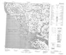
Maps showing Kuuviup Paanga, Baie-d'Hudson; Kativik, Quebec
Kuuviup Paanga is a Unincorporated area located in Baie-d'Hudson; Kativik, Quebec.
- Latitude: 61° 33' 50'' North (decimal: 61.5639140)
- Longitude: 77° 38' 52'' West (decimal: -77.6476947)
- Topography Feature Category: Unincorporated area
- Geographical Feature: Lieu-dit
- Canadian Province/Territory: Quebec
- Location: Baie-d'Hudson; Kativik
- Atlas of Canada Locator Map: Kuuviup Paanga
- GPS Coordinate Locator Map: Kuuviup Paanga Lat/Long
Kuuviup Paanga NTS Map Sheets