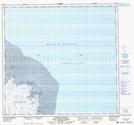
Maps showing Récifs Asuqaap Ikkarualungit, Rivière-Koksoak; Kativik, Quebec
Récifs Asuqaap Ikkarualungit is a Shoal located in Rivière-Koksoak; Kativik, Quebec.
- Latitude: 58° 48' 31'' North (decimal: 58.8086111)
- Longitude: 68° 17' 58'' West (decimal: -68.2994443)
- Topography Feature Category: Shoal
- Geographical Feature: Récifs
- Canadian Province/Territory: Quebec
- Location: Rivière-Koksoak; Kativik
- Atlas of Canada Locator Map: Récifs Asuqaap Ikkarualungit
- GPS Coordinate Locator Map: Récifs Asuqaap Ikkarualungit Lat/Long
Récifs Asuqaap Ikkarualungit NTS Map Sheets