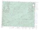
Maps showing Pic des Os Perdus, Mont-Albert; La Haute-Gaspésie, Quebec
Pic des Os Perdus is a Mountain located in Mont-Albert; La Haute-Gaspésie, Quebec.
- Latitude: 48° 59' 13'' North (decimal: 48.9869899)
- Longitude: 65° 54' 28'' West (decimal: -65.9077179)
- Topography Feature Category: Mountain
- Geographical Feature: Pic
- Canadian Province/Territory: Quebec
- Location: Mont-Albert; La Haute-Gaspésie
- Atlas of Canada Locator Map: Pic des Os Perdus
- GPS Coordinate Locator Map: Pic des Os Perdus Lat/Long
Pic des Os Perdus NTS Map Sheets