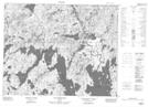
Maps showing Méandre Kamishta Uashtit, Mont-Valin; Le Fjord-du-Saguenay, Quebec
Méandre Kamishta Uashtit is a River feature located in Mont-Valin; Le Fjord-du-Saguenay, Quebec.
- Latitude: 51° 54' 53'' North (decimal: 51.9147818)
- Longitude: 70° 7' 51'' West (decimal: -70.1308466)
- Topography Feature Category: River feature
- Geographical Feature: Méandre
- Canadian Province/Territory: Quebec
- Location: Mont-Valin; Le Fjord-du-Saguenay
- Atlas of Canada Locator Map: Méandre Kamishta Uashtit
- GPS Coordinate Locator Map: Méandre Kamishta Uashtit Lat/Long
Méandre Kamishta Uashtit NTS Map Sheets