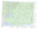
Maps showing Poste de la Rivière-aux-Bouleaux, Rivière-au-Tonnerre; Minganie, Quebec
Poste de la Rivière-aux-Bouleaux is a Miscellaneous located in Rivière-au-Tonnerre; Minganie, Quebec.
- Latitude: 50° 17' 22'' North (decimal: 50.2894987)
- Longitude: 65° 31' 25'' West (decimal: -65.5235270)
- Topography Feature Category: Miscellaneous
- Geographical Feature: Unclassified
- Canadian Province/Territory: Quebec
- Location: Rivière-au-Tonnerre; Minganie
- Atlas of Canada Locator Map: Poste de la Rivière-aux-Bouleaux
- GPS Coordinate Locator Map: Poste de la Rivière-aux-Bouleaux Lat/Long
Poste de la Rivière-aux-Bouleaux NTS Map Sheets