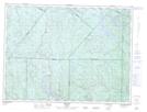
Maps showing Poste de Sacré-Coeur, Sacré-C¿ur; La Haute-Côte-Nord, Quebec
Poste de Sacré-Coeur is a Miscellaneous located in Sacré-C¿ur; La Haute-Côte-Nord, Quebec.
- Latitude: 48° 14' 32'' North (decimal: 48.2422447)
- Longitude: 69° 48' 29'' West (decimal: -69.8081114)
- Topography Feature Category: Miscellaneous
- Geographical Feature: Unclassified
- Canadian Province/Territory: Quebec
- Location: Sacré-C¿ur; La Haute-Côte-Nord
- Atlas of Canada Locator Map: Poste de Sacré-Coeur
- GPS Coordinate Locator Map: Poste de Sacré-Coeur Lat/Long
Poste de Sacré-Coeur NTS Map Sheets