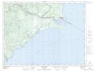
Maps showing Ruisseau Lapointe, Colombier; La Haute-Côte-Nord, Quebec
Ruisseau Lapointe is a River located in Colombier; La Haute-Côte-Nord, Quebec.
- Latitude: 48° 51' 40'' North (decimal: 48.8611458)
- Longitude: 68° 53' 13'' West (decimal: -68.8869911)
- Topography Feature Category: River
- Geographical Feature: Ruisseau
- Canadian Province/Territory: Quebec
- Location: Colombier; La Haute-Côte-Nord
- Atlas of Canada Locator Map: Ruisseau Lapointe
- GPS Coordinate Locator Map: Ruisseau Lapointe Lat/Long
Ruisseau Lapointe NTS Map Sheets