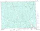
Maps showing Lac Christine, Lac-au-Brochet; La Haute-Côte-Nord, Quebec
Lac Christine is a Lake located in Lac-au-Brochet; La Haute-Côte-Nord, Quebec.
- Latitude: 48° 19' 21'' North (decimal: 48.3225237)
- Longitude: 69° 46' 2'' West (decimal: -69.7672778)
- Topography Feature Category: Lake
- Geographical Feature: Lac
- Canadian Province/Territory: Quebec
- Location: Lac-au-Brochet; La Haute-Côte-Nord
- Atlas of Canada Locator Map: Lac Christine
- GPS Coordinate Locator Map: Lac Christine Lat/Long
Lac Christine NTS Map Sheets