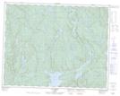
Maps showing Lac Brûlé, Lac-Jérôme; Minganie, Quebec
Lac Brûlé is a Lake located in Lac-Jérôme; Minganie, Quebec.
- Latitude: 50° 36' 0'' North (decimal: 50.6000630)
- Longitude: 65° 4' 51'' West (decimal: -65.0807151)
- Topography Feature Category: Lake
- Geographical Feature: Lac
- Canadian Province/Territory: Quebec
- Location: Lac-Jérôme; Minganie
- Atlas of Canada Locator Map: Lac Brûlé
- GPS Coordinate Locator Map: Lac Brûlé Lat/Long
Lac Brûlé NTS Map Sheets