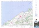
Maps showing Zec de la Rivière-Mitis, Sainte-Jeanne-d'Arc; La Mitis, Quebec
Zec de la Rivière-Mitis is a Conservation area located in Sainte-Jeanne-d'Arc; La Mitis, Quebec.
- Latitude: 48° 26' 23'' North (decimal: 48.4397650)
- Longitude: 67° 59' 18'' West (decimal: -67.9883437)
- Topography Feature Category: Conservation area
- Geographical Feature: Zone d'exploitation contrôlée
- Canadian Province/Territory: Quebec
- Location: Sainte-Jeanne-d'Arc; La Mitis
- Atlas of Canada Locator Map: Zec de la Rivière-Mitis
- GPS Coordinate Locator Map: Zec de la Rivière-Mitis Lat/Long
Zec de la Rivière-Mitis NTS Map Sheets