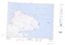
Maps showing Île Niaqunnguutialuk, Rivière-Koksoak; Kativik, Quebec
Île Niaqunnguutialuk is a Island located in Rivière-Koksoak; Kativik, Quebec.
- Latitude: 61° 36' 28'' North (decimal: 61.6076849)
- Longitude: 71° 31' 25'' West (decimal: -71.5237231)
- Topography Feature Category: Island
- Geographical Feature: Île / Ile
- Canadian Province/Territory: Quebec
- Location: Rivière-Koksoak; Kativik
- Atlas of Canada Locator Map: Île Niaqunnguutialuk
- GPS Coordinate Locator Map: Île Niaqunnguutialuk Lat/Long
Île Niaqunnguutialuk NTS Map Sheets