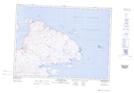
Maps showing Îlot Tulugarnaq, Rivière-Koksoak; Kativik, Quebec
Îlot Tulugarnaq is a Island located in Rivière-Koksoak; Kativik, Quebec.
- Latitude: 61° 31' 56'' North (decimal: 61.5321646)
- Longitude: 71° 38' 58'' West (decimal: -71.6495103)
- Topography Feature Category: Island
- Geographical Feature: Îlot / Ilot
- Canadian Province/Territory: Quebec
- Location: Rivière-Koksoak; Kativik
- Atlas of Canada Locator Map: Îlot Tulugarnaq
- GPS Coordinate Locator Map: Îlot Tulugarnaq Lat/Long
Îlot Tulugarnaq NTS Map Sheets