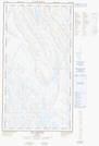
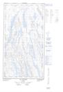
Maps showing Lacs Qamaniik, Rivière-Koksoak; Kativik, Quebec
Lacs Qamaniik is a Lake located in Rivière-Koksoak; Kativik, Quebec and has an elevation of 114 meters.
- Latitude: 58° 31' 11'' North (decimal: 58.5196291)
- Longitude: 69° 35' 27'' West (decimal: -69.5909680)
- Topography Feature Category: Lake
- Geographical Feature: Lacs
- Canadian Province/Territory: Quebec
- Elevation: 114 meters
- Location: Rivière-Koksoak; Kativik
- Atlas of Canada Locator Map: Lacs Qamaniik
- GPS Coordinate Locator Map: Lacs Qamaniik Lat/Long
Lacs Qamaniik NTS Map Sheets