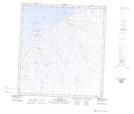
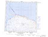
Maps showing Lac Imirtavik, Ivujivik; Kativik, Quebec
Lac Imirtavik is a Lake located in Ivujivik; Kativik, Quebec and has an elevation of 34 meters.
- Latitude: 62° 24' 49'' North (decimal: 62.4136700)
- Longitude: 77° 55' 43'' West (decimal: -77.9284975)
- Topography Feature Category: Lake
- Geographical Feature: Lac
- Canadian Province/Territory: Quebec
- Elevation: 34 meters
- Location: Ivujivik; Kativik
- Atlas of Canada Locator Map: Lac Imirtavik
- GPS Coordinate Locator Map: Lac Imirtavik Lat/Long
Lac Imirtavik NTS Map Sheets