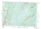
Maps showing Saint-Isidore-d'Auckland, Saint-Isidore-de-Clifton; Le Haut-Saint-François, Quebec
Saint-Isidore-d'Auckland is a Village located in Saint-Isidore-de-Clifton; Le Haut-Saint-François, Quebec.
- Latitude: 45° 16' North (decimal: 45.2667000)
- Longitude: 71° 31' West (decimal: -71.5166999)
- Topography Feature Category: Village
- Geographical Feature: Municipalité
- Canadian Province/Territory: Quebec
- Location: Saint-Isidore-de-Clifton; Le Haut-Saint-François
- GPS Coordinate Locator Map: Saint-Isidore-d'Auckland Lat/Long
Saint-Isidore-d'Auckland NTS Map Sheets