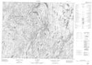
Maps showing Lac Ouvert, Rivière-aux-Outardes; Manicouagan, Quebec
Lac Ouvert is a Lake located in Rivière-aux-Outardes; Manicouagan, Quebec.
- Latitude: 51° 12' 35'' North (decimal: 51.2097926)
- Longitude: 70° 8' 3'' West (decimal: -70.1342000)
- Topography Feature Category: Lake
- Geographical Feature: Lac
- Canadian Province/Territory: Quebec
- Location: Rivière-aux-Outardes; Manicouagan
- Atlas of Canada Locator Map: Lac Ouvert
- GPS Coordinate Locator Map: Lac Ouvert Lat/Long
Lac Ouvert NTS Map Sheets