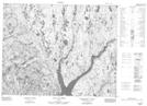
Maps showing Lac du Moucheronnage, Rivière-aux-Outardes; Manicouagan, Quebec
Lac du Moucheronnage is a Lake located in Rivière-aux-Outardes; Manicouagan, Quebec.
- Latitude: 51° 20' 26'' North (decimal: 51.3406265)
- Longitude: 70° 12' 58'' West (decimal: -70.2161400)
- Topography Feature Category: Lake
- Geographical Feature: Lac
- Canadian Province/Territory: Quebec
- Location: Rivière-aux-Outardes; Manicouagan
- Atlas of Canada Locator Map: Lac du Moucheronnage
- GPS Coordinate Locator Map: Lac du Moucheronnage Lat/Long
Lac du Moucheronnage NTS Map Sheets