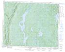
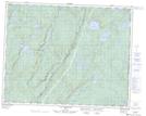
Maps showing Chute Keshcouhn, Rivière-Nipissis; Sept-Rivières, Quebec
Chute Keshcouhn is a Falls located in Rivière-Nipissis; Sept-Rivières, Quebec.
- Latitude: 51° 1' 17'' North (decimal: 51.0214451)
- Longitude: 65° 51' 21'' West (decimal: -65.8557563)
- Topography Feature Category: Falls
- Geographical Feature: Chute
- Canadian Province/Territory: Quebec
- Location: Rivière-Nipissis; Sept-Rivières
- Atlas of Canada Locator Map: Chute Keshcouhn
- GPS Coordinate Locator Map: Chute Keshcouhn Lat/Long
Chute Keshcouhn NTS Map Sheets