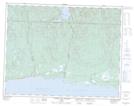
Maps showing Rivière-à-la-Chaloupe-Est, Rivière-au-Tonnerre; Minganie, Quebec
Rivière-à-la-Chaloupe-Est is a Unincorporated area located in Rivière-au-Tonnerre; Minganie, Quebec.
- Latitude: 50° 17' 10'' North (decimal: 50.2861677)
- Longitude: 65° 7' 4'' West (decimal: -65.1177080)
- Topography Feature Category: Unincorporated area
- Geographical Feature: Hameau
- Canadian Province/Territory: Quebec
- Location: Rivière-au-Tonnerre; Minganie
- Atlas of Canada Locator Map: Rivière-à-la-Chaloupe-Est
- GPS Coordinate Locator Map: Rivière-à-la-Chaloupe-Est Lat/Long
Rivière-à-la-Chaloupe-Est NTS Map Sheets