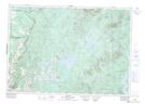
Maps showing Ruisseau Lambert, East Hereford; Coaticook, Quebec
Ruisseau Lambert is a River located in East Hereford; Coaticook, Quebec.
- Latitude: 45° 5' 36'' North (decimal: 45.0933333)
- Longitude: 71° 29' 13'' West (decimal: -71.4869443)
- Topography Feature Category: River
- Geographical Feature: Ruisseau
- Canadian Province/Territory: Quebec
- Location: East Hereford; Coaticook
- Atlas of Canada Locator Map: Ruisseau Lambert
- GPS Coordinate Locator Map: Ruisseau Lambert Lat/Long