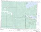
Maps showing Réserve indienne Shoal Lake 37A, Kenora, Ontario
Réserve indienne Shoal Lake 37A is a Indian Reserve located in Kenora, Ontario.
- Latitude: 49° 28' 50'' North (decimal: 49.4805999)
- Longitude: 95° 8' 54'' West (decimal: -95.1482999)
- Topography Feature Category: Indian Reserve
- Geographical Feature: Réserve indienne
- Canadian Province/Territory: Ontario
- Location: Kenora
- Atlas of Canada Locator Map: Réserve indienne Shoal Lake 37A
- GPS Coordinate Locator Map: Réserve indienne Shoal Lake 37A Lat/Long