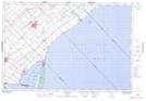
Maps showing 52 Hill, Kent, Ontario
52 Hill is a Mountain located in Kent, Ontario and has an elevation of 192 meters.
- Latitude: 42° 29' 00'' North (decimal: 42.4833333)
- Longitude: 81° 40' 59'' West (decimal: -81.6830555)
- Topography Feature Category: Mountain
- Geographical Feature: Hill
- Canadian Province/Territory: Ontario
- Elevation: 192 meters
- Location: Kent
- Atlas of Canada Locator Map: 52 Hill
- GPS Coordinate Locator Map: 52 Hill Lat/Long