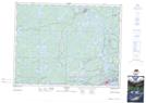
Maps showing Abbott's Island, Kenora, Ontario
Abbott's Island is a Island located in Kenora, Ontario and has an elevation of 334 meters.
- Latitude: 49° 58' 32'' North (decimal: 49.9755555)
- Longitude: 94° 37' 8'' West (decimal: -94.6188888)
- Topography Feature Category: Island
- Geographical Feature: Island
- Canadian Province/Territory: Ontario
- Elevation: 334 meters
- Location: Kenora
- Atlas of Canada Locator Map: Abbott's Island
- GPS Coordinate Locator Map: Abbott's Island Lat/Long