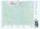
Maps showing Adams, Cochrane, Ontario
Adams is a Geographical area located in Cochrane, Ontario.
- Latitude: 48° 19' 11'' North (decimal: 48.3197222)
- Longitude: 81° 16' 7'' West (decimal: -81.2686111)
- Topography Feature Category: Geographical area
- Geographical Feature: Geographic Township
- Canadian Province/Territory: Ontario
- Location: Cochrane
- Atlas of Canada Locator Map: Adams
- GPS Coordinate Locator Map: Adams Lat/Long