Canada Topographic Maps

Agawa River Topo Maps

Topography maps and Latitude/Longitude Location

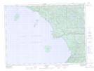
Maps showing Agawa River, Algoma, Ontario

Agawa River is a River located in Algoma, Ontario and has an elevation of 340 meters.

  • Latitude: 47° 21' 5'' North   (decimal: 47.3513888)
  • Longitude: 84° 38' 14'' West   (decimal: -84.6372222)
  • Topography Feature Category: River
  • Geographical Feature: River
  • Canadian Province/Territory: Ontario
  • Elevation: 340 meters
  • Location: Algoma
  • Atlas of Canada Locator Map: Agawa River
  • GPS Coordinate Locator Map: Agawa River Lat/Long

Agawa River NTS Map Sheets

041N07 Agawa Bay Topographic Map at 1:50,000 scale

041N08 Grey Owl Lake Topographic Map at 1:50,000 scale

041N09 Blackspruce Lake Topographic Map at 1:50,000 scale

041N10 Old Woman Lake Topographic Map at 1:50,000 scale

041N16 Kinniwabi Lake Topographic Map at 1:50,000 scale

041N Michipicoten Topographic Map at 1:250,000 scale

 
Buy Topographic Maps DVD
Newsletter Sign-up

Yes, I want to receive map store discounts.


Bookmark and Share