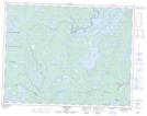
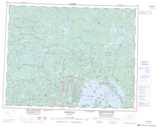
Maps showing Armstrong Station, Thunder Bay, Ontario
Armstrong Station is a Unincorporated area located in Thunder Bay, Ontario.
- Latitude: 50° 17' 57'' North (decimal: 50.2991666)
- Longitude: 89° 2' 20'' West (decimal: -89.0388888)
- Topography Feature Category: Unincorporated area
- Geographical Feature: Post Office
- Canadian Province/Territory: Ontario
- Location: Thunder Bay
- Atlas of Canada Locator Map: Armstrong Station
- GPS Coordinate Locator Map: Armstrong Station Lat/Long
Armstrong Station NTS Map Sheets