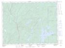
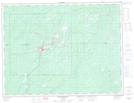
Maps showing Barehead Creek, Thunder Bay, Ontario
Barehead Creek is a River located in Thunder Bay, Ontario and has an elevation of 332 meters.
- Latitude: 48° 52' 32'' North (decimal: 48.8755555)
- Longitude: 85° 55' 17'' West (decimal: -85.9213888)
- Topography Feature Category: River
- Geographical Feature: Creek
- Canadian Province/Territory: Ontario
- Elevation: 332 meters
- Location: Thunder Bay
- Atlas of Canada Locator Map: Barehead Creek
- GPS Coordinate Locator Map: Barehead Creek Lat/Long
Barehead Creek NTS Map Sheets