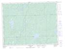
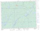
Maps showing Beaton River, Algoma, Ontario
Beaton River is a River located in Algoma, Ontario and has an elevation of 304 meters.
- Latitude: 49° 6' 27'' North (decimal: 49.1074999)
- Longitude: 84° 39' 21'' West (decimal: -84.6558333)
- Topography Feature Category: River
- Geographical Feature: River
- Canadian Province/Territory: Ontario
- Elevation: 304 meters
- Location: Algoma
- Atlas of Canada Locator Map: Beaton River
- GPS Coordinate Locator Map: Beaton River Lat/Long
Beaton River NTS Map Sheets