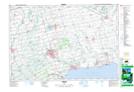
Maps showing Bill's Corners, Norfolk, Ontario
Bill's Corners is a Unincorporated area located in Norfolk, Ontario and has an elevation of 232 meters.
- Latitude: 42° 58' 8'' North (decimal: 42.9688888)
- Longitude: 80° 15' 39'' West (decimal: -80.2608333)
- Topography Feature Category: Unincorporated area
- Geographical Feature: Locality
- Canadian Province/Territory: Ontario
- Elevation: 232 meters
- Location: Norfolk
- Atlas of Canada Locator Map: Bill's Corners
- GPS Coordinate Locator Map: Bill's Corners Lat/Long